In cooperation
Between
Regional Center for Remote Sensing for North African States
And
National Center for Remote Sensing in Lebanon
And
The Lebanese Foundation for Renewable Energy
Organize
A specialized training program – Online
About
GIS Strategies for Large Scale Solar PV Projects: Optimizing Site Selection, Risk Assessment, and Stakeholder Communication
During the period 2 – 4 July 2024
Introduction:
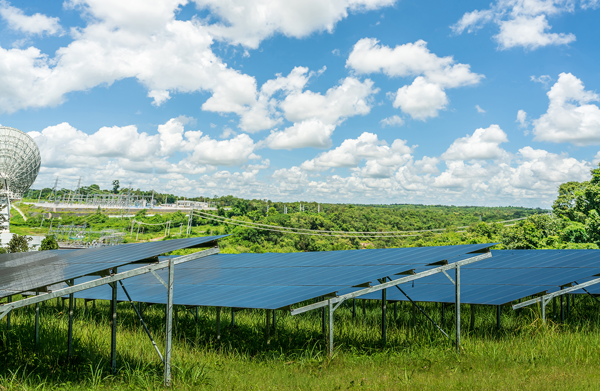
Geographic Information Systems (GIS) has become indispensable in the renewable energy sector, particularly in the planning, development, and management. This program offers participants an in-depth exploration of GIS concepts and their practical application in the solar PV energy domain. Additionally, participants will gain the knowledge and skills necessary to leverage GIS technology for site selection, flood risk assessment, economic analysis, and stakeholder communication in solar PV projects.
Objectives:
- Introduce participants to GIS concepts and basics, including data collection, analysis, and visualization using modern technology.
- Introduce participants to the role of GIS in solar PV projects.
- Provide a deep understanding of GIS’s role in selecting solar PV sites, using spatial data to identify optimal locations.
- Utilize GIS to analyze costs and benefits of building solar PV projects.
- Introduce the assessment of solar PV site risks, with a particular emphasis on flooding risk, using GIS.
- Enhance participants’ ability to create detailed spatial reports and analyses, supporting informed decision-making for solar energy investments.
Teach how to effectively communicate GIS analysis results to stakeholders to support planning and sustainable development.
Targeted parties:
- Ministries, bodies, institutions and specialized national centers related to the
acourse contents.
- Researchers and specialists in scientific and academic institutions, universities, research bodies and nat
- Regional centers of specialization.
- Scientific societies, civil society bodies working in this field, other relevant parties and the private sector.
Organizers:
1- The Regional Center for Remote Sensing for North African States. –CRTEAN
2- The National Center for Remote Sensing in Lebanon- NCRS
3-The Lebanese Foundation for Renewable Energy – LFRE
Course language:
The language of the training course will be in English, and for clarification, Arabic or French may be used if necessary.
Trained experts:
- Jaafar Serhan From the Lebanese National Center for Remote Sensing
- Ali Ali From Lebanese National Center for Remote Sensing
- Ali Alakbar Dawi From Lebanese National Center for Remote Sensing
With help
- Lamia Khemiri From : CRTEAN
- Fatima Bouchneb From : CRTEAN
Logistical and organizational aspects:
The course will be held remotely from 2 – 4 July 2024 from Tunis and Beirut, via virtual attendance and via the ZOOM platform (the Zoom link will be shared at a later stage)
Certificates of attendance:
Certificates will be awarded for attending the course, accredited by the Regional Center for Remote Sensing for North African Countries, the National Center for Remote Sensing in Lebanon, and Lebanese Foundation for Renewable Energy – upon completion of the activities of this course.
Program Schedule:
Day 1: Introduction to GIS Concepts and Basics (3 hours)
| Time | Session |
| 09:00 AM – 10:00 AM | Understanding GIS Fundamentals |
| 10:00 AM – 10:45 AM | Data Collection and Management |
| 10:45 AM – 11:00 AM | Break |
| 11:00 AM – 12:00 PM | Data Creation, Analysis, and Visualization |
Day 2: GIS in Solar PV Projects (3 hours)
| Time | Session |
| 09:00 AM – 10:00 AM | Role of GIS in Solar PV Projects |
| 10:00 AM – 10:45 AM | Selecting Solar PV Sites |
| 10:45 AM – 11:00 AM | Break |
| 11:00 AM – 12:00 PM | Cost-Benefit Analysis |
Day 3: Advanced GIS Applications in Solar PV Projects (3.5 hours)
| Time | Session |
| 09:00 AM – 10:00 AM | Assessing Flooding Risks in Solar PV projects |
| 10:00 AM – 11:00 AM | Creating Spatial Reports and Analyses |
| 11:00 AM – 11:15 AM | Break |
| 11:15 AM – 12:00 PM | Stakeholder Communication |
| 12:00 PM – 12:15 PM | Recap of key learnings |
| 12:15 PM – 12:30 PM | Open Q&A session |
Program Schedule (Detailed):
- Day 1: Introduction to GIS Concepts and Basics
Time: 3 hours
- Session 1: Understanding GIS Fundamentals (60 mins)
- Introduction to Geographic Information Systems (GIS)
- Importance of spatial data in decision-making
- Overview of GIS components: hardware, software, data, people, and methods.
- Session 2: Data Collection and Management (45 mins)
- Methods of data collection (remote sensing, GPS, surveys, etc.)
- Data formats and sources (raster, vector, tabular)
- Introduction to data management in GIS: organization, storage, and retrieval.
- Break (15 mins)
- Session 3: Data Creation, Analysis, and Visualization (60 mins)
- Basic spatial analysis techniques (overlay, buffering, proximity analysis, etc.)
- Introduction to visualization techniques (maps, charts, graphs)
- Practical exercises: Creating simple maps and conducting basic analysis using GIS software.
- Day 2: GIS in Solar PV Projects:
Time: 3 hours.
- Session 4: Role of GIS in Solar PV Projects (60 mins)
- Overview of solar PV projects and their importance in renewable energy.
- Role of GIS in site selection, planning, and optimization.
- Case studies of successful solar PV projects utilizing GIS.
- Session 5: Selecting Solar PV Sites (45 mins)
- Factors influencing site selection.
- Using GIS tools to identify optimal locations for solar PV projects.
- Practical exercises: Site suitability analysis using GIS software.
- Break (15 mins)
- Session 6: Cost-Benefit Analysis (60 mins)
- Utilizing GIS to analyze costs and benefits of solar PV projects.
- Factors to consider in economic analysis.
- Day 3: Advanced GIS Applications in Solar PV Projects:
Time: 3.5 hours
- Session 7: Assessing Risks (60 mins)
- Introduce risks in solar PV projects (e.g., flooding risk, environmental impact, etc.)
- Using GIS for flood risk analysis and mitigation.
- Case studies and practical examples.
- Session 8: Creating Spatial Reports and Analyses(60 mins)
- Techniques for creating detailed spatial reports and analyses.
- Presenting analysis results effectively through maps, charts, and narratives
- Practical exercise: Creating a spatial report using GIS.
- Break (15 mins)
- Session 9: Stakeholder Communication (45 mins)Importance of communicating GIS analysis results to stakeholders.Strategies for effective communication.Practical exercises: Communicating GIS analysis to different stakeholders.
- Conclusion and Q&A (30 min)
- Recap of key learnings (15 mins)
- Open Q&A session (15 mins
Participants form via audio-visual remote communication – Zoom
| First Name: | الاسم الشخصي: |
| Middle Name: | الاسم الأوسط: |
| Last Name: | اسم العائلة: |
| Nationality: | الجنسية: |
| Country of residence: | بلد الإقامة: |
| Gender: | الجنس: |
| E-mail: | البريد الاكتروني: |
| Phone No. : | رقم الهاتف: |
| Organization: ☐Government ☐Local NGO ☐International NGO ☐Private Sector ☐Academia ☐Independent Expert ☐Land/property owner or user ☐Other:____________________________ | المنظمة: ☐الحكومة ☐منظمات المجتمع المدني المحلية ☐منظمات عالمية ☐القطاع الخاص ☐القطاع الأكاديمي ☐خبير مستقل ☐مستخدم/ة / مالك/ة للأراضي أو الأصول ☐غير ذلك:_____________________________ |
| I would like to attend the training: Online | أرغب في حضور التدريب: ☐افتراضيًا |
| Please explain why you are interested in this training and how it will benefit your personal or your organization development in this field(250 Words max). | يرجى توضيح سبب اهتمامك بهذاالتدريب وكيف سيفيد تطويرالشخصي أوالمؤسسى في هذا المجال (250كلمةكحدأقصى). |
ملاحظة :يرســل النموذج إلــــى :Note: Send the form to
gfaour@cnrs.edu.lb ،crtean.gashut@yahoo.com ، crtean.khemiri@yahoo.com
قبل بنهاية يوم 15يونيو( جوان)2024. .Before the end of June 25 , 2024
Form